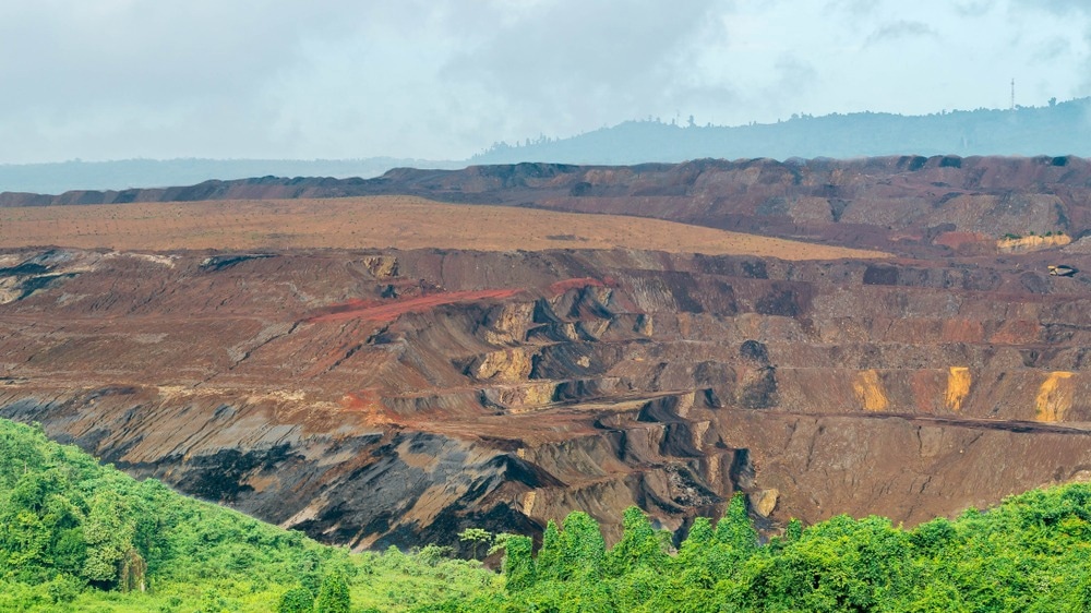
In a recent article published in the journal Remote Sensing, researchers presented a novel approach for detecting bare coal in open-pit mining areas using Landsat imagery.

Image Credit: hilmawan nurhatmadi/Shutterstock.com
The increasing demand for coal, coupled with the environmental impacts of mining, necessitates effective monitoring techniques to ensure sustainable practices. The study aims to develop a Bare Coal Index (BCI) that enhances the identification of bare coal areas, improving resource management and minimizing ecological disturbances. The authors emphasize the importance of accurate detection methods in addressing the challenges posed by open-pit mining, including land degradation and habitat destruction.
Background
Open-pit mining is a prevalent method for extracting coal, which has significant environmental implications. The process often leads to vegetation removal, soil erosion, and alterations in local ecosystems. Traditional methods of monitoring coal extraction have limitations, particularly in terms of accuracy and efficiency.
Remote sensing technologies, particularly those utilizing satellite imagery, offer a promising solution for monitoring mining activities on a large scale.
The Landsat program provides high-resolution images that can be analyzed to identify land cover changes, including bare coal. However, existing indices for coal detection often struggle with high commission rates and inaccuracies due to overlapping land cover types. This study addresses these challenges by proposing a new index specifically designed for bare coal detection.
The Current Study
The methodology employed in this study involves several key steps of data acquisition, index development, thresholding and morphological processing, and validation. For data acquisition, the authors utilized high-quality Landsat imagery with less than 10% cloud cover, focusing on the period from July to September across three study areas. The Google Earth Engine (GEE) platform was used to access and process the satellite data.
The Bare Coal Index (BCI) was developed to enhance the detection of bare coal. The index is based on the reflectance values of specific spectral bands, particularly the shortwave infrared (SWIR) bands, which are sensitive to coal's spectral characteristics. The BCI was formulated to effectively distinguish bare coal from other land cover types.
A threshold of 0.8 was applied to classify pixels with a bare coal fraction greater than or equal to 90% as bare coal. The results underwent mathematical morphology processing to smooth boundaries and retain patches larger than four pixels, resulting in a refined distribution map of bare coal areas.
A portion of the study area was selected as a validation site to assess the accuracy of the BCI. Ground truth data was manually extracted, and the classification accuracy was evaluated using the “BCs/non-BCs” criterion. Metrics such as overall accuracy, omission rate, commission rate, and Kappa coefficient were calculated to quantify the performance of the proposed method.
Results and Discussion
The results demonstrated that the BCI effectively identified bare coal areas in the study regions. The classification accuracy was notably high, with an average overall accuracy, omission rate, commission rate, and Kappa coefficient of 97%, 16.93%, 3.87%, and 0.87, respectively. These metrics indicate that the proposed method is reliable for detecting bare coal pixels.
However, the study also identified limitations in the detection process. For instance, a significant area was missed in the Shengli coalfield due to the average bare coal fraction being lower than the set threshold. The spectral analysis revealed that the reflectance of the SWIR2 band was lower than that of the SWIR1 band in this area, complicating the detection process. The authors suggest that future research should focus on understanding the spectral characteristics of different coal types and their variations over time.
The study further explored the BCI's applicability in other open-pit mining areas across Inner Mongolia. The findings demonstrated strong agreement between the extracted bare coal extent and the actual mining regions, confirming the BCI's accuracy and reliability. The authors also discussed the potential of integrating multispectral LiDAR-derived intensity data with the BCI for more precise monitoring of mining activities. This data fusion approach could enhance the accuracy of surface change monitoring and resource management.
Conclusion
The study successfully developed a novel Bare Coal Index (BCI) for detecting bare coal in open-pit mining areas using Landsat imagery.
The proposed method demonstrated high accuracy and reliability, addressing the limitations of existing coal detection techniques. The findings highlight the importance of remote sensing technologies in monitoring mining activities and their environmental impacts. The authors advocate for further research to refine the BCI and explore its integration with other data sources for enhanced monitoring capabilities. Overall, the study contributes valuable insights into sustainable mining practices and the role of advanced remote sensing methods in environmental management.
Source:
Li Z., Zhao Y., et al. (2024). A Novel Index for Detecting Bare Coal in Open-Pit Mining Areas Based on Landsat Imagery. Remote Sensing 16(24), 4648. DOI: 10.3390/rs16244648, https://www.mdpi.com/2072-4292/16/24/4648