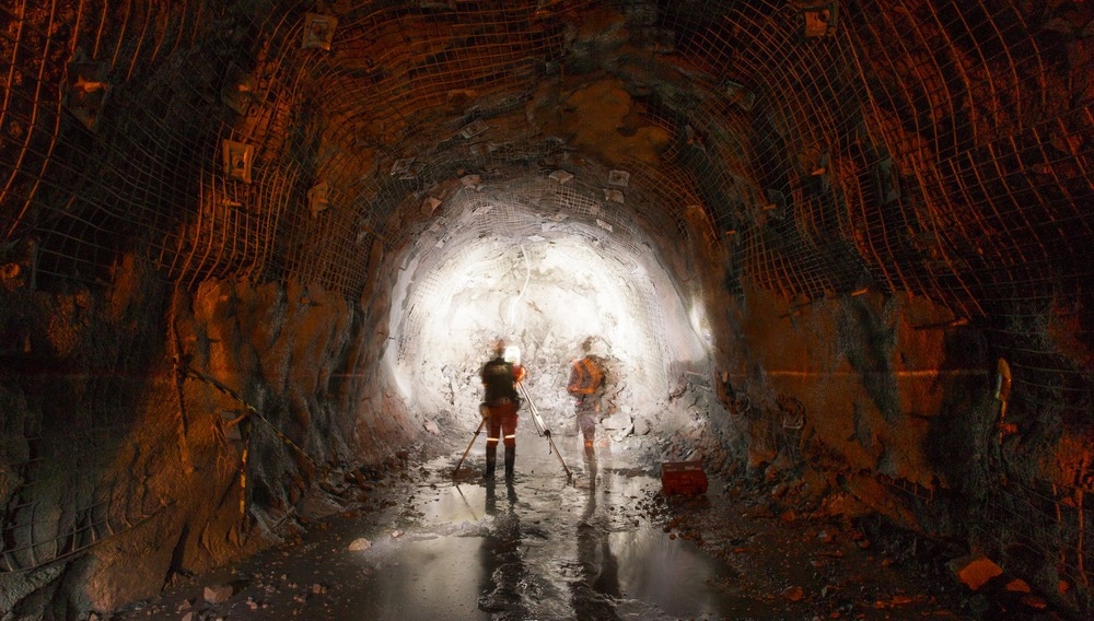
Making data collection in underground mining easier, cheaper, and more accessible will make companies more productive by enabling more digitization for the sector. RockMass Technologies is a Canadian startup that provides a data collection platform for underground mining and related applications. Its co-founder and CEO was recently recognized for this contribution in an industry award.

Image Credit: I Made Pasek/Shutterstock.com
The Challenges of Collecting Underground Mining Data
Industries such as manufacturing and logistics have embraced digitization, using Internet of Things (IoT) technologies, big data analytics, and artificial intelligence (AI) programs for decades to drive increased operational efficiency and maximize profits. Heavier, dirtier, and typically more conservative industries like construction and mining are starting to adopt these new ways of working, often referred to as “Industry 4.0”.
Data collection is essential to digitization. However, the tools and systems developed for data collection in other industries often do not work underground.
Accurately mapping underground mines with geospatial data, ore deposit locations, and rock quality metrics has proven challenging across the sector. However, start-ups are beginning to address these issues.
One of the critical challenges in underground data collection for mining is that global positioning system (GPS) and global navigation satellite system (GNSS) signals are not available underground. This rules out the most common geospatial data collection platforms across industries above ground.
The difficult conditions mine operators face underground also limit their ability to collect data. A lack of natural light, restricted physical access to the mine, and intrinsic safety (IS) requirements that significantly limit the use of electronic systems all make underground data collection particularly challenging.
Companies working on this problem use simultaneous localization and mapping (SLAM) principles to generate a laser scan or point cloud to create a digital model of the mine’s physical dimensions. These have had to be adapted from indoor urban applications to address the challenges unique to underground mine environments.
Laser scanners need to be specially adapted to work safely underground. This is largely due to the explosion risk when potentially sparking equipment is used in underground sites where volatile gasses have accumulated.
These IS requirements stipulate that, for example, metal parts have to be treated to ensure they will not spark when dropped onto rock. For electronics, the task is even harder as they need to be made so that explosive gas like methane can never penetrate the outer casing and interact with circuitry.
As a result, laser scanners are still underutilized in the mining industry, and underground mapping and data gathering is often performed manually.
RockMass’s Products Make Underground Data Collection Possible
RockMass is a Canadian startup that provides data collection solutions for the mining industry and other related sectors.
RockMass’s products offer automatic data collection and processing, as well as effective collection and analysis of critical structural and geological data.
The company supplies a “Mapper” device designed to withstand the rigors of mining’s harsh environments.
The device is a handheld tool with built-in LiDAR sensors, a flashlight, rangefinder, camera, and an inertial measurement unit (IMU). The LiDAR sensors have 7 m of range. Human workers wear the device on an ergonomic harness system that the company says is appropriate for extended periods of use.
As well as deploying the “Mapper” devices, RockMass also provides a bespoke software solution to handle the data gathered underground. Its software provides dashboard functionality for mine managers and integrates data with other mining enterprise software, including Rocscience, Seequent, Deswik, and Micromine.
Rockmass, established in 2016, has already deployed its data collection system with mine operator partners in four continents. Its co-founder and CEO, Shelby Yee, was recently recognized for its contribution with an industry award presented by Australia’s Northern Miner trade publication. The Young Mining Professionals award recognizes excellence in mining leadership.
What Can the RockMass Platform Do for Underground Mining?
The RockMass platform enables easy, cheap, and accurate data collection for several metrics important to underground mine operators. As well as mapping the dimensions of underground mines, it also identifies structures, lithologies, contacts, and traces underground.
Workers estimating ore grade can record their estimations directly in the “Mapper” device, adding more data to pore over in the connected dashboard software. The platform uses rock mass rating (RMR) data and the Q-system classification method.
The platform also creates stereonets in real time; these are used to visualize and solve geological problems, such as removing structural tilt from models.
The result of all of this data collection is to make it easier and cheaper to digitize underground mining.
The Digitized Future of Mining
The RockMass team is currently developing more features for its data collection platform, and integrating it with more pieces of mining and geotechnical research industry software.
Technological innovations such as this will drive increased digitization in the mining sector. This will enable mine operators to use big data analytics, AI, and automation more effectively to drive increased productivity.
References and Further Reading
Digitalisation in mines: the future of connectivity in the mining industry. (2020) [Online] Mining Technology. Available at: https://www.mining-technology.com/sponsored/digitalisation-in-mines-the-future-of-connectivity-in-the-mining-industry/ (Accessed on 20 December 2022).
ExScan 3D underground mapping. (2021) [Online] CSIRO. Available at: https://www.csiro.au/en/work-with-us/industries/mining-resources/Sensing/ExScan (Accessed on 20 December 2022).
Geological and Geotechnical Mapping for Underground Environments. [Online] RockMass. Available at: https://www.rockmasstech.com/solutions/ (Accessed on 20 December 2022).
Khawaja, S. (2022). Digitalisation and its impact on the mining industry. [Online] Mining Technology. Available at: https://www.mining-technology.com/sponsored/digitalisation-and-its-impact-on-the-mining-industry/ (Accessed on 20 December 2022).
Peter Munk & Eira Thomas Annual Awards. [Online] Young Mining Professionals. Available at: https://youngminingprofessionals.com/awards (Accessed on 20 December 2022).
Rival, S., et al (2019). A Preliminary Investigation of Mobile Mapping Technology for Underground Mining. IGARSS 2019 - 2019 IEEE International Geoscience and Remote Sensing Symposium. doi.org/10.1109/IGARSS.2019.8898518
Disclaimer: The views expressed here are those of the author expressed in their private capacity and do not necessarily represent the views of AZoM.com Limited T/A AZoNetwork the owner and operator of this website. This disclaimer forms part of the Terms and conditions of use of this website.