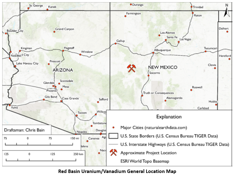
First American Uranium Inc. obtained the final draft of its NI 43-101 Report for the Red Basin Uranium/Vanadium Property, an early-stage exploration property in Catron County, New Mexico. The project, which comprises 26 optioned lode claims totaling 537 acres (217 hectares), is located 250 miles (402 km) north of America’s only operational uranium mill.
 Red Basin Uranium/Vanadium General Location Map. Image Credit: First American Uranium
In the 1950s, 1,194 pounds of U3O8 were produced in the project area from ore with an average U3O8 grade of 0.17% (McLemore & Chenoweth, 2017). The presence of uranium/vanadium deposits on the company’s land has been verified by many sources, according to the Report, showing the potential of turning into an advanced-stage project.
The Gulf Oil Corporation has conducted extensive historical exploration on the land, drilling more than 1,000 shallow holes and defining four possible mineral zones.
The airborne radiometric survey, drilling to verify historical Gulf Oil data and test new targets, environmental baseline studies, and an environmental assessment (EA) or environmental impact study (EIS) are among the recommendations made in the report to propel the project and promote a resource calculation.
Although a resource estimate for the company’s project is not included in the Report, earlier historical studies (DOE, 1980; Rio Grande Resources, 2012) provided non-43-101-compliant resource estimations for the property of 1.6 to 6.5 million pounds U3O8 (triuranium octoxide).
First American is not treating these historical estimates as current mineral resources since a competent individual has not performed sufficient research to categorize them as current mineral resources or mineral reserves. The estimations’ dependability is unknown; hence sampling and drilling will be required to verify the estimates.
Receiving this 43-101 report is an important milestone toward advancing our understanding of the Red Basin Uranium/Vanadium Project’s value and for planning our exploration program to help define the project’s resource potential. As the report indicates, the project’s location, combined with the extent of past exploration, suggests the Red Basin property is a very attractive project in the making. Timing is also an advantage due to rising demand for carbon-free sources of electricity, geopolitical tension with Russia, and uranium prices reaching 10-year highs.
Shawn Balaghi, Chief Executive Officer, First American Uranium Inc.
John E. Hiner and Frank Bain, two seasoned professional geologists (P. Geos) with uranium exploration experience and in-depth local knowledge and expertise, wrote the 43-101 Report.
The authors drew their knowledge from a variety of historical sources, including a report from the New Mexico Bureau of Mines and Mineral Resources in June 1981 by Richard M. Chamberlin, PhD, titled “Uranium Potential of the Datil Mountains-Pie Town Area, Catron County, New Mexico” (Chamberlin, 1981); a Department of Energy report from 1980 titled “An Assessment Report on Uranium in the United States of America”; and published historical assay from the Red Basin Project described in a May 1970 inter-office report titled “Reconnaissance for Uranium in the Datil Region West of Socorro, New Mexico." The Report was certified as complying with NI 43-101 by John Hiner.
Major mining firms including Phillips Petroleum, Occidental Petroleum, Conoco, and Gulf Oil Corporation have conducted uranium exploration in the Red Basin region. Over 350 feet down, known uranium deposits were discovered through historic drilling.
Through the US Forest Service and access roads, the Red Basin Uranium/Vanadium Project property is reachable from Highway 60. For this phase of the project, no additional infrastructure is needed or anticipated.